Thanks very much for joining me and taking the time to read through the last few week’s posts. I hope you enjoyed them and found them to be informative. Contact me at jason@awetelemetry.co.za for more information on collars or to discuss the best solution for your upcoming project.
After a short break catching up on some admin and visiting customers in the field I am pleased to present the fourth instalment of the Guide to Wildlife Tracking series. Please contact me at Jason@awetelemetry.co.za for a full pdf version.
GNSS (GPS) UHF
Logging with local radio delivery
Technology summary
GNSS UHF collars, also known as UHF download collars, offer fully remote automated data collection. Depending on the system deployed, the delivery of the data could be automatic to a network of ‘base stations’ or data could be manually downloaded wirelessly from the collar by field personnel. Location data is autonomously collected by the tracking device and stored in memory on the tracking device or immediately sent to a base station. GNSS UHF tracking devices have been around for a long time and are small and low power enough to be used on small animals. The greatest challenges with this technology option are the need of line-of-sight between the tracking device and base station or download receiver, the practical range and of the radio link and the download speed that is achievable via the radio link. It can be a cost-effective option for the collection of location data over time as it requires no manual effort from the user for data collection but if there is no base station infrastructure in place, the data needs to be manually downloaded in the field by the user.
How do GNSS UHF tracking devices work?
The Global Positioning System (GPS) was the first commercially available Global Navigation Satellite System (GNSS) available – and is still the most widely used. There are more systems in operation such as Galileo, BeiDou and GLONASS. Modern GNSS receiver modules are capable of using multiple of these systems to improve performance in acquiring locations.
Ultra High Frequency (UHF) radios generally operate in the Industrial, Scientific and Medical (ISM) radio frequency band. The ISM band allows for licence-free operation and the allowed frequency and duty cycle depend on the regulations of each country. The most common frequency bands used in UHF radios are around 433 MHz, 868 MHz or 900 MHz. The correct frequency needs to be selected to comply with local regulations.
GNSS UHF tracking devices combine a GNSS receiver with UHF radio module and some memory for data storage. The GNSS receiver module acquires location coordinates and time from GNSS systems such as GPS. Once a location is acquired the tracking device stores it in memory with the time and date. Collected data is sent to a computing platform on the Internet via a base station network if installed, or may be downloaded wirelessly from the tracking device in the field – depending on the system deployed. The platform could make the data available to the user via email, an Application Programming Interface (API) or via a web portal.
Typically GNSS UHF tracking devices are configured to acquire locations on a set schedule and can autonomously download data to base station infrastructure if in place. Alternatively the tracking devices can be downloaded opportunistically in the field with specialised receivers. Each brand of GNSS UHF tracking device may have its own proprietary method of operating and receivers required for downloading data. Some GNSS UHF tracking device operate on standardised protocols and may be compatible with base stations across brands.
Some common types of UHF solutions available are:
Low Power Wide Area Network
There are various kinds of Low Power Wide Area Network radio technologies around. The key concept of these technologies is to send data at very low data rates in a very narrow frequency band e.g. SigFox, or by spreading signals in multiple bands across a broader spectrum e.g. LoRaWAN. The main aim is to improve the sensitivity of the receiver so that out-of-band noise has less of an impact on the receive signal. Typical maximum practical range when there is ‘line-of-sight’ between the transmitter and receiver is in the order of 15 km to 20 km. This is vastly reduced when there is obstruction in the transmit path. The time to send up a single location at such a range is in the order of two seconds, making it impractical to download a lot of data using these technologies. In some cases the modulation technique is changed when the signal strength is high to provide for slow data rate when far from a receiver and higher data rate when nearer to the receiver.
LPWAN networks could either be licensed, commercially operated networks such as SigFox or self operated networks in the ISM radio band such as LoRaWAN. In some cases commercial entities offer LoRaWAN networks as a service.
In a LPWAN network the end device, called a ‘node’, typically reports its data to a ‘base station’ on set interval and waits a short period for any commands that my be queued for it by the network.
There are some factors to consider when using LPWAN technology for wildlife tracking.
As there is unlikely to be a commercial LPWAN operator in rural areas, a LPWAN network consisting of multiple base stations with Internet connections will need to be installed and maintained in the area.
A tracking platform service provider will need to be involved so that data from LPWAN networks can be collected, handled and made available to the user via a web interface.
Data downloading from devices may be challenging due to the slow data rate. This comes into play when animals roam out of range of a network and return.
Radio range in dense vegetation or mountainous terrain will be poor and more base stations are required in these conditions.
Generally LPWAN devices do not offer regular opportunities for communication to the device, and the user has to queue commands on the network for delivery at the next scheduled transmission from the tracking device.
LPWAN technologies comply to a standard and theoretically once there is a network available, different brands of tracking devices could be configured on the network if allowed by the network provider.
Traditional modulation such as FSK or OOK
GNSS UHF tracking devices that make use of traditional modulation such as Frequency Shift Keying (FSK) or On-Off Keying (OOK) in their radio modules are also available on the market. These systems generally do not get as much range as LPWAN radios can, but can nonetheless still get decent range of up to 10 km or more in line-of-sight conditions. The radio links are also typically configured for higher throughput. Depending on the system deployed, these tracking devices can automatically report their locations or download previously stored locations when in range of a base station, or a user can opportunistically download data directly from the tracking device when in range. Some of these systems have been used to great success as an alternative to GNSS Satellite tracking devices in areas devoid of cellular networks. Some points of consideration for GNSS UHF tracking devices using traditional radio technologies:
Radio range in dense vegetation is poor.
Systems are proprietary and tracking devices from one company will not be compatible with base stations or receivers from another company.
Depending on the system, these devices offer more regular opportunities to send commands to the tracking devices.
Download speeds are much higher than LPWAN devices, but can still take long if there are many points that need to be downloaded.
Some systems employing this technology are suitable for animals that leave the network range and return as they have the capability of downloading logged data.
How do you track an animal with a GNSS UHF device?
Data points from GNSS UHF tracking devices are automatically uploaded from the device via the radio network and back down to a service provider’s platform on the Internet. Some systems require the user to retrieve the collected data from a base station if there is no means of connecting the base station to the Internet. Alternatively, if a traditional UHF radio system is used, field personnel can download data in the field with a UHF data downloader. GNSS UHF tracking devices are often also fitted with a VHF transmitter so that field personnel can track the animal with a VHF receiver and, when in range, can then do data downloads via UHF radio. Traditional GNSS UHF tracking devices can be used without the need to maintain a network of base stations, but it is then required that field personnel manually download collected data wirelessly from the tracking devices. Some GNSS UHF tracking devices allow the user to request a current location from the device. This feature is very useful when there is a need to physically observe an animal. Once in range of the tracking device, a new locations is requested, and the exact GPS coordinates are returned to the UHF receiver after about a minute. These coordinates can simply be plugged into a GPS device or smartphone to guide the field personnel to the exact location of the animal – no need to continuously sweep the horizon for VHF signal or try to estimate how far it is by the signal strength. This feature is however not available on GNSS UHF devices that make use of LPWAN networks and the user generally has to wait for the tracking device to send its latest location at the next scheduled time.
GNSS considerations
The maximum accuracy of a civilian GNSS receiver is about 2 m. In practice however the accuracy of acquired locations are typically 5 m to 10 m in good conditions. Each acquired location has a varying degree of accuracy depending on where the satellites used for the acquisition are located. The highest accuracy can be achieved if the GNSS receiver’s antenna has an unobstructed vantage point to the full sky. In these ideal conditions multiple satellites from different segments of the sky are used in calculating the location – providing quick and accurate results. If the GNSS antenna is partially obstructed by terrain or vegetation, or if it is oriented away from the open sky, the GNSS receiver will take longer to acquire a location and the accuracy of that location will be reduced because the satellites used may be within the same area of sky, which reduces the ability to get an accurate ‘fix’. Good GNSS devices measure the accuracy of each location and provide a horizontal dilution of precision (HDOP) which gives an indication of the possible error on the acquired location. Because of the high cost of satellite data transmission, not all GNSS Satellite tracking devices send HDOP data with each point, but rather use the HDOP value as part of a criteria to determine whether a location is accurate enough to store for upload.
GNSS UHF device power consumption
GNSS UHF devices can be very power efficient depending on the brand and how they are configured. There are two primary elements that contribute to to battery draw namely the GNSS receiver and the radio module.
GNSS receiver power consumption
The amount of battery power consumed by a GNSS receiver whilst acquiring satellite data from the GNSS system, and the determination of location depends on the brand and components used and whether an active or passive antenna is connected. Active antennas compensate for signal loss in the feeding cable between the GNSS receiver and the antenna element. Active antennas are generally not required where short antenna cables are used – but this is dependent on the design of the tracking device or collar.
Most GNSS receivers store satellite ephemeris data from the GNSS satellites so that when they start up again within a certain period of time (two hours or less), some of the data is still valid and the time to get a location – known as Time to Fix (TTF) – is shorter than it would be when starting with no data – known as Time to First Fix (TTFF). Every two hours or so the receiver needs to replenish its ephemeris data to reduce any future TTF. When a GNSS device is started up in good sky view within a minute of its last ‘fix’, it could get a new ‘fix’ in a TTF of 1 second. This is called a ‘hot start’. When starting up 5 minutes to 2 hours after refreshing its ephemeris data, a GNSS receiver can ‘fix’ in a TTF of 5 to 15 seconds – known as a ‘warm start’. When starting up with no ephemeris data or with data that is more than 2 hours old most GNSS receivers can get a new fix in a TTFF of less than 30 seconds in very good sky view conditions – known as a ‘cold start’. These TTF and TTFF times (typically advertised on the GNSS receiver data sheet) are best-case times. In reality it is unlikely for the GNSS receiver to start up in ideal sky view conditions when fitted to an animal. Any partial obstruction of the sky or adverse orientation of the antenna has an adverse effect on the TTFF and TTF. GNSS cellular tracking devices are configured to allow a finite amount of time for the GNSS receiver to successfully acquire a location. Depending on the device the time allowed to fix could be from 1 minute up to 5 minutes, after which it ‘times out’ and registers no position for that time. GNSS receivers that are fitted to animals that frequent dense vegetation, canyons or ravines can easily consume more than 4 times the power when compared those fitted to animals that roam open grass plains for example. Cloud cover and precipitation also attenuates signals from GNSS satellites – increasing TTF and therefore also the power consumption.
Radio module power consumption
The other contributor to power consumption is the Radio module. UHF tracking devices can be configured to be very frugal on battery usage as the radio transmissions can be configured to be spaced apart much further than VHF transmitters for example. Dense vegetation and mountainous terrain does not affect power consumption by the UHF radio although it will affect power consumption of the GNSS receiver.
Suitability of GNSS UHF devices for different applications
GNSS UHF tracking devices can be quite small and are suitable for tracking small to medium-sized to very large animals. For the purpose of comparison with the other technologies discussed in this guide we will consider the same applications again.
Physically finding an animal
When it is required to visually monitor an animal or a group of animals, the efficacy of GNSS UHF devices depends on a few factors. If the terrain frequented by the animal fitted with the tracking device has sparse vegetation and base stations fully cover the area, it is very likely that the device will regularly report its location and field personnel can simply go to the latest location and start searching for VHF signal, or alternatively get an updated location from the tracking device if this feature is supported. If there are insufficient base stations to cover the entire area the best solution would be to use the GNSS UHF device in conjunction with a VHF transmitter to locate the animal. The procedure is best started by finding VHF signal. Once VHF signal is obtained the field personnel can move in the direction of the animal until observed. If the UHF device has the capability to provide a requested location, it can significantly shorten the search time because the user can request the exact location as soon as they are in range of the UHF radio.
Collecting location data
Good GNSS UHF tracking devices capture and store location data so that it can either be automatically uploaded to a platform via a network of base stations, or field personnel can download the data via a radio link when within range. Some however do not offer this feature and unsuccessful uplinks are never recovered. When compared to VHF transmitters where data collection is manual:
The act of physically tracking the animal is not regularly required and the use of the technology does not massively alter its behaviour due to the field personnel’s proximity to the animal.
Each location point is automatically captured by the GNSS receiver and it is therefore easy to get a rich data set.
The collection of location information does not consume a lot of costly resources. Data can be manually downloaded regularly, or once at the end of a study period. Some systems deliver data automatically if there is a network of base stations to deliver the information.
As apposed to VHF transmitters, getting animal locations at night time from a GNSS UHF tracking device is no more challenging than getting them in the day. This allows for safer studies on nocturnal animals. It is however a possibility that data downloads can be difficult in the day if the animals are underground or hide in dense vegetation during the day.
The efficacy of GNSS UHF collars are dependent on terrain and animal behaviour.
Collecting other data
If more information such as activity level or temperature is needed, some types of GNSS UHF tracking device can include that in the data set with minimal impact on battery consumption.
GNSS UHF tracking collar costs
GNSS UHF tracking collars are the second least expensive tracking collars in this guide, but there may be additional costs in maintaining a network of base stations. The impact of base station outages can be very large if multiple collars rely on the infrastructure.
Cost of Equipment – Low to High
The cost of a GNSS UHF collar is low when compared to other solutions in this guide. In addition to the collar, the user will need to purchase a UHF receiver and/or configure a network of base stations – which can be costly. Maintenance of the network is another cost that needs to be considered.
Cost of Deployment – High
Fitting and removing tracking collars to wildlife is very expensive. Depending on the animal being collared, various techniques are used to capture and often tranquillise the animal before fitting the collar. It is sometimes necessary to charter spotter airplanes, helicopters and specialised wildlife veterinarians to get the job done. The total cost in resources to locate, tranquillise and fit tracking devices to animals can sometimes exceed the costs of the tracking equipment.
Service Fees – Zero to Medium
There may be a service fee associated with GNSS UHF collars if there is a network of base stations involved. The fees generally cover the cost of the provider’s platform, maintenance fees for the base stations and communications subscriptions such as cellular contracts or satellite service subscriptions for the base station backhaul. Base station fees are generally charged on a monthly basis. Collar access fees may be charged monthly or bundled into the upfront cost of the collar. There should be no fees charged for collars in the absence of a base station network.
Cost of Use – Medium to High
During normal operation there is no intervention required for a GNSS UHF tracking collar to acquire location data. If there is a network of base stations, the data should be automatically delivered to the user. Base station networks are costly to maintain and there are likely to be service and management fees involved for such a network. In the absence of base stations, field personnel have to manually download data from the collars from time to time. These devices can collect a lot of data and provide rich data sets.
Total Cost – Medium to High
When considering all costs, GNSS UHF tracking collars are efficient at gathering data because this is done automatically without any manual field work required. There are however costs in accessing the data – either through manual downloads in the field, or as a result of maintenance and service fees associated with operating a network of base stations.
GNSS UHF Technology rating
Reliability – Very Good to Medium
GNSS UHF collars can be very reliable. Because the tracking devices are small in size, they can be contained in a smaller enclosure on the collar. The smaller a collar, the less chance it has of suffering damage due to bumps, bites or wear whilst deployed. Multiple components in these devices also increase the chance of a critical component failure – although these are very rare and there is a greater chance of physical damage or shock on the housing to be a root cause of failure. If the collection of data relies on the continuous operation of the base stations – any outage of a base station may affect data delivery for the duration of the outage – depending on the system.
Ease of Use – Medium
For data collection there is nothing for the user to do if the collar automatically uploads information through a network of base stations. There is however an additional complication of maintaining or operating base stations. In the absence of a network of base stations, field personnel have to download data manually.
Data granularity – Excellent
Data granularity can be very high. The amount of data that can be collected depends on the duration of the deployment, the number and type of batteries that are accommodated and the schedule of data collection and upload. Since this is a very power efficient option these devices offer the best data granularity of all the technologies in this guide.
Battery Life – Excellent
Battery life of a GNSS UHF tracking device depends on the configured logging and upload schedule, animal behaviour, and terrain. On the whole excellent battery life with the lowest battery consumption per location of all the technologies discussed in this guide.
Things to consider when ordering a GNSS UHF collar
Retrieval of data from GNSS UHF collars can be challenging if the study area is very large and is not covered by a set of base stations to provide for automatic data retrieval. It is important to confirm whether the system’s frequency allows it to be legally deployed in the study area. The continual operational and maintenance effort required to keep base stations in good working order is often underestimated.
Thanks for taking the time to read part three, a little bit of “repetition” from Part 2 but its always good to revise! Part 3 talks through the use of Satellites as a means of communicating data from the animal to the satellite network and back to Earth.
GNSS (GPS) Satellite
Automated tracking without on-site terrestrial infrastructure
Technology summary
GNSS Satellite collars, also known as GPS Satellite collars, offer fully remote automated data collection and delivery. Location data is autonomously collected by the tracking device and delivered to the user via a satellite network and the Internet. The technologies involved have been around for a very long time but the physical size of the tracking devices have only been small enough to track medium sized animals since around 2011. The greatest challenges with this technology option are the need of good sky view for data communication, the cost of satellite data services and the amount of power required to communicate to a satellite. It can be a cost-effective option for the collection of location data over time as it requires no manual effort from the user. VHF transmitters are often included with GNSS Satellite devices as an option to track the animal when visual monitoring or physical intervention is needed.
How do GNSS Satellite tracking devices work?
The Global Positioning System (GPS) was the first commercially available Global Navigation Satellite System (GNSS) available – and is still the most widely used. There are more systems in operation such as Galileo, BeiDou and GLONASS. Modern GNSS receiver modules are capable of using multiple of these systems to improve performance in acquiring locations.
GNSS Satellite tracking devices combine a GNSS receiver with satellite module and some memory for data storage. The GNSS receiver module acquires location coordinates and time from GNSS systems such as GPS. Once a location is acquired the tracking device stores it in memory with the time and date. Collected data is sent to a computing platform on the Internet via a satellite network. The platform could make the data available to the user via email, an Application Programming Interface (API) or via a web portal.
Typically GNSS Satellite tracking devices are configured to acquire locations on a set schedule and to attempt to upload data on a second schedule. If the orientation of the satellite antenna or terrain does not permit uploading, these devices often have the ability to store the data until there is an opportunity to upload the data in a subsequent scheduled upload.
Satellites orbit the earth at a distance (from earth) and a velocity such that the outward centrifugal acceleration experienced by the satellite due to its circular motion exactly cancels out the force of gravity enacted on it by earth.
There are various satellite communication services available for animal tracking. Generally they can be divided into two system types:
Geostationary satellite systems
Geostationary satellites orbit the earth at a distance of about 35 786 km from earth. Their orbital period – the time it takes them to complete one full orbit of the earth – is exactly one day. They are made to orbit in the same direction as the earth turns and it means that to an observer from earth the satellite appears to be stationary. The advantage of such a system is that a communications antenna can be fixed in a specific direction to establish a good link. A common example of such a system is Satellite TV where satellite antenna ‘dishes’ are aimed at the satellite which appears to be at a stationary location in the sky. Wildlife tracking solutions can obviously not accommodate a satellite dish, but due to the low data rate needed to send location data an antenna with a wide radiation pattern can be used. This relieves the need for ‘pointing’ an antenna – making animal tracking using a geostationary satellite system possible. There are however a further constraints to using Geostationary satellites for animal tracking:
Due to the vast distance of a geostationary satellite from earth the satellite transceiver module needs very high transmit power – which is not ideal for battery life.
The required aperture for a patch antenna is quite large making the transceivers larger than would otherwise be the case.
Line-of-sight from the transceiver to the satellite is required for successful communications. This means that if the animal happens to be behind something that obstructs the path from the satellite to the tracking device it is unlikely to have success in transmitting the data.
Data that is uploaded to a geostationary satellite transponder is immediately downlinked to a ground station from where it is delivered to the intended destination. The time between data upload to a satellite and delivery via a ground station is generally less than a few seconds. The size of the required antenna, and amount of battery required to operate a tracking system that uses a geostationary satellite limits its application to larger animals. Geostationary satellite systems are therefore only used for the tracking of elephants as they are able to carry the bulk needed.
Low Earth Orbit satellite systems
Low Earth Orbit (LEO) satellite systems consist of a ‘fleet’ of satellites that orbit the earth at much closer distance (200 to 2000 km). This means that the location of satellites in relation to an observer in earth is continuously changing as the satellites orbit in and out of view. Fortunately due to their comparatively shorter distance from earth it is not required to have a high-gain directional antenna in order to transfer data to a satellite that is in view. Less transmit power is also required to upload data to a LEO satellite when compared to a geostationary satellite. The way a LEO satellites transfer data to earth is by downlinking any data received during its orbit to a ground station as it passes over it. For this reason there can be a delay (typically a few minutes) from the time data is uplinked to a satellite until the satellite is in range of a ground station. Depending on the satellite system, some LEO satellites relay or route uploaded information between each other until the data gets to a satellite that is in range of an earth station for downlink and delivery to its destination. These systems offer very low latency of a few seconds or less between data uplink and delivery to the final destination. Constraints related to using LEO satellites for animal tracking:
While the power required to transmit to a LEO satellite is much less than that required to transmit to a geostationary satellite due to the relatively closer proximity of the satellite, it is still quite a distance (781 km for Iridium) and requires more power than some terrestrial radio solutions such as cellular or other radio based solutions.
The antenna aperture for a module that communicates with a LEO satellite can be much smaller than is required for a geostationary satellite for the same frequency if a patch antenna is used. This allows for smaller antenna configurations.
Line-of-sight to a satellite at the time of upload is crucial for success. Antenna orientation on the animal is therefore crucial to maximise the chance of having line-of-sight to a satellite at the time of an attempted upload. Antennas that require good sky view are generally still a limiting factor in the design of an effective device for use on smaller animals.
How do you track an animal with a GNSS Satellite device?
Data points from GNSS Satellite tracking devices are automatically uploaded from the device via the satellite networks and back down to a service provider’s platform on the Internet. Generally the user of the system does not need to perform any field work to get access to the data. The data is either delivered directly via email to the user or it may be accessed via an application that provides options to visualise the data on maps or download the data for analysis or use in third party applications.
Because geographic coordinates are acquired and uploaded on a schedule, the user will only get the latest location at the time of a successful upload. The acquired coordinates can be viewed on a map or put into a handheld GPS receiver to guide the user to the point. If a VHF transmitter is included in the tracking device, the last received coordinates is a good place to start searching for VHF signal when physical observation is required.
GNSS considerations
The maximum accuracy of a civilian GNSS receiver is about 2 m. In practice however the accuracy of acquired locations are typically 5 m to 10 m in good conditions. Each acquired location has a varying degree of accuracy depending on where the satellites used for the acquisition are located. The highest accuracy can be achieved if the GNSS receiver’s antenna has an unobstructed vantage point to the full sky. In these ideal conditions multiple satellites from different segments of the sky are used in calculating the location – providing quick and accurate results. If the GNSS antenna is partially obstructed by terrain or vegetation, or if it is oriented away from the open sky, the GNSS receiver will take longer to acquire a location and the accuracy of that location will be reduced because the satellites used may be within the same area of sky, which reduces the ability to get an accurate ‘fix’. Good GNSS devices measure the accuracy of each location and provide a horizontal dilution of precision (HDOP) which gives an indication of the possible error on the acquired location. Because of the high cost of satellite data transmission, not all GNSS Satellite tracking devices send HDOP data with each point, but rather use the HDOP value as part of a criteria to determine whether a location is accurate enough to store for upload.
GNSS Satellite device power consumption
GNSS Satellite devices can be relatively power efficient depending on the brand and how they are configured. There is however a limitation to the type of batteries that are appropriate for use in these devices due to the high burst current required during transmissions to a satellite. There are two primary elements that contribute to to battery draw namely the GNSS receiver and the Satellite module.
GNSS receiver power consumption
The amount of battery power consumed by a GNSS receiver whilst acquiring satellite data from the GNSS system, and the determination of location depends on the brand and components used and whether an active or passive antenna is connected. Active antennas compensate for signal loss in the feeding cable between the GNSS receiver and the antenna element. Active antennas are generally not required where short antenna cables are used – but this is dependent on the design of the tracking device or collar.
Most GNSS receivers store satellite ephemeris data from the GNSS satellites so that when they start up again within a certain period of time (two hours or less), some of the data is still valid and the time to get a location – known as Time to Fix (TTF) – is shorter than it would be when starting with no data – known as Time to First Fix (TTFF). Every two hours or so the receiver needs to replenish its ephemeris data to reduce any future TTF. When a GNSS device is started up in good sky view within a minute of its last ‘fix’, it could get a new ‘fix’ in a TTF of 1 second. This is called a ‘hot start’. When starting up 5 minutes to 2 hours after refreshing its ephemeris data, a GNSS receiver can ‘fix’ in a TTF of 5 to 15 seconds – known as a ‘warm start’. When starting up with no ephemeris data or with data that is more than 2 hours old most GNSS receivers can get a new fix in a TTFF of less than 30 seconds in very good sky view conditions – known as a ‘cold start’. These TTF and TTFF times (typically advertised on the GNSS receiver data sheet) are best-case times. In reality it is unlikely for the GNSS receiver to start up in ideal sky view conditions when fitted to an animal. Any partial obstruction of the sky or adverse orientation of the antenna has an adverse effect on the TTFF and TTF. GNSS cellular tracking devices are configured to allow a finite amount of time for the GNSS receiver to successfully acquire a location. Depending on the device the time allowed to fix could be from 1 minute up to 5 minutes, after which it ‘times out’ and registers no position for that time. GNSS receivers that are fitted to animals that frequent dense vegetation, canyons or ravines can easily consume more than 4 times the power when compared those fitted to animals that roam open grass plains for example. Cloud cover and precipitation also attenuates signals from GNSS satellites – increasing TTF and therefore also the power consumption.
Satellite module power consumption
The other major contributor to power consumption is the Satellite module. Some Satellite tracking devices allow for a schedule to be configured so that multiple data points can be uploaded in one communication session. Saving multiple data points and sending them together saves some power as it takes time for the module to register to a network every time it sends data and therefore sending multiple data points in a session is more efficient. There is often a limitation to the amount of data that can be packed into a single satellite transmission so the solution has to strike a balance between multiple data points and the maximum amount of data points allowed by the satellite service provider. The trade-off for saving battery power through scheduled uploads is that the user will get less frequent updates of the latest location of the animal than if each location was sent at the time of its acquisition. Satellite service coverage maps show where the services are available. Some satellite service providers such as Iridium offer global coverage. All satellite systems rely on line-of-sight between the satellite module antenna and one of the orbiting satellites. Poor sky view from the antenna is bad for battery power consumption in three ways:
higher transmit power is used because satellite modules adjust their transmit gain based on the strength of signal from the network and retry transmission,
upload efficiency is reduced because failed data uploads need to be sent multiple times before they are successfully delivered,
the time taken to register to a network and upload data is longer due to poor link quality and
when the antenna only has visibility to a portion of the sky there is a low probability of a LEO satellite being in the portion of the sky that the antenna has direct line-of-site to.
Suitability of GNSS Satellite devices for different applications
GNSS Satellite tracking devices are larger than other tracking technologies and currently are only suitable for tracking medium-sized to very large animals. For the purpose of comparison with the other technologies discussed in this guide we will consider the same applications again.
Physically finding an animal
When it is required to visually monitor an animal or a group of animals, the efficacy of GNSS Satellite devices depends on a few factors. If the terrain frequented by the animal fitted with the tracked device has sparse vegetation and the animal does not frequent areas with poor sky view such as ravines, it is feasible for field personnel to wait for the next upload and go searching in the area as soon as the location is uploaded. It can be frustrating if the scheduled upload was unsuccessful, but that is the nature of satellite communication. It is also difficult to get the location if the field personnel can not access the latest data due to poor cellular reception on their phone or laptop. If the tracking device is configured to upload data infrequently to save on battery life, it can be inconvenient to have to wait for a very long time for the next upload from the tracking device. For these reasons a VHF transmitter is often included in a GNSS Satellite collar. The field personnel would use the last received location as a starting point to search for VHF signal from the transmitter as described in the chapter on VHF transmitters.
Collecting location data
Good GNSS Satellite tracking devices capture and store location data and automatically upload the data to a platform for the user to access. Some however do not offer this feature and unsuccessful uplinks are never recovered. When compared to VHF transmitters where data collection is manual:
The act of physically tracking the animal regularly is not required and the use of the technology does not alter its behaviour due to the field personnel’s proximity to the animal.
Each location point is automatically captured and it is therefore easy to get a rich data set.
The collection of location information does not consume a lot of costly resources – e.g. no field personnel, vehicles or fuel needed.
As apposed to VHF transmitters, getting animal locations at night time from a GNSS Satellite tracking device is no more challenging than getting them in the day. This allows for safer studies on nocturnal animals.
The efficacy of GNSS Satellite collars are dependent on terrain and animal behaviour.
Collecting other data
If more information such as activity level or temperature is needed, some types of GNSS Satellite tracking device can include that in the data set with minimal impact on battery consumption. Since satellite data transmission is expensive there is likely to be an impact on running costs.
GNSS Satellite tracking collar costs
GNSS Satellite tracking collars are the most expensive collars in this guide, and generally have an associated service fee for platform access and data costs. The additional costs are however quickly recovered due to the automation and low cost of use.
Cost of Equipment – High
The cost of a GNSS Satellite collar is the highest of any other discussed in this guide. This is mostly due to the component costs of the satellite communication module and antenna when compared with other communication technologies. In addition satellite service subscriptions and data transfer costs are significantly higher than the equivalent service on a cellular network.
Cost of Deployment – High
Fitting and removing tracking collars to wildlife is very expensive. Depending on the animal being collared, various techniques are used to capture and often tranquillise the animal before fitting the collar. It is sometimes necessary to charter spotter airplanes, helicopters and specialised wildlife veterinarians to get the job done. The total cost in resources to locate, tranquillise and fit tracking devices to animals can sometimes exceed the costs of the tracking equipment.
Service Fees – High
There is typically a service fee associated with GNSS Satellite collars. The fees generally cover the cost of the provider’s platform and the satellite service subscription and network charges. Fees may be charged on a monthly basis, or bundled into the upfront cost of the collar.
Cost of Use – Very Low
During normal operation there is no intervention required for a GNSS Satellite tracking collar to acquire and upload data for access by the user. These devices can collect a lot of data and provide rich data sets.
Total Cost – Medium to High
When considering all costs, GNSS Satellite tracking collars are very cost effective at gathering data because this is done automatically without any manual field work required. When used in good Satellite coverage and with the correct configuration for their environment they offer very good cost per location for very little user effort.
GNSS Satellite Technology rating
Reliability – Very Good
GNSS Satellite collars can be very reliable. Whilst they are smaller in size these days, there is more electronics and batteries that need to be housed in a collar or harness than is the case for a VHF transmitter or a GNSS Cellular tracking device. The bulkier a collar, the more chance it has of suffering damage due to bumps, bites or wear whilst deployed. It also has the additional complication that the design has to be such that the satellite module antenna faces skyward as often as possible. More components also increase the chance of a critical component failure – although these are very rare and there is a greater chance of physical damage or shock on the housing to be a root cause of failure.
Ease of Use – Excellent
For data collection there is nothing for the user to do. The GNSS Satellite tracking collar and the provider’s platform perform all the heavy lifting and data is delivered to the user wherever they may be.
Data granularity – Very Good
Data granularity can be very high. The amount of data that can be collected depends on the duration of the deployment, the amount of batteries that are accommodated and the schedule of data collection and upload.
Battery Life – Good
Battery life of a GNSS Satellite tracking device depends on the configured logging and upload schedule, animal behaviour, terrain and Satellite coverage. On the whole, if configured correctly for the situation, these devices offer fair battery life for medium animals and good battery life for larger animals that can carry a bigger battery pack.
Things to consider when ordering a GNSS Satellite collar
Mountainous terrain or dense vegetation are challenging environments for GNSS Satellite collars. Although they are likely to deliver data, the regularity of uploads may suffer as a result of poor sky view. In some situations there are no other options available e.g. in very remote locations with no other communications infrastructure around or where it is costly to maintain local radio infrastructure.
Thank you for joining us for the second part in our Guide to Wildlife Tracking Technology. Today we discuss the use and role of GNSS Cellular Collars. Enjoy!
GNSS (GPS) Cellular
The first automated tracking
Technology summary
GNSS Cellular collars, also known as GPS GSM or GPS Cellular collars, offer fully remote automated data collection and delivery. Location data is autonomously collected by the tracking device and delivered to the user via cellular networks and the Internet. The technologies involved have been around for a very long time and the physical size of the tracking devices are getting ever smaller. One of the greatest challenges with this technology option remains the poor reach of cellular networks into rural areas. It is a cost-effective option for the collection of location data over time as it requires no manual effort from the user. VHF transmitters are often included with GNSS Cellular devices as an option to track the animal when visual monitoring is needed.
How do GNSS Cellular tracking devices work?
The Global Positioning System (GPS) was the first commercially available Global Navigation Satellite System (GNSS) available – and is still the most widely used. There are more systems in operation such as Galileo, BeiDou and GLONASS. Modern GNSS receiver modules are capable of using multiple of these systems to improve performance in acquiring locations.
GNSS cellular tracking devices combine a GNSS receiver with cellular module and some memory for data storage. The GNSS receiver module acquires location coordinates and time from GNSS systems such as GPS. Once a location is acquired the tracking device stores it in memory with the time and date. Collected data is sent to a computing platform on the Internet via a cellular network. The platform could make the data available to the user via email, an Application Programming Interface (API) or via a web portal.
Typically GNSS Cellular tracking devices are configured to acquire locations on a set schedule and to attempt to upload data on a second schedule. If the network coverage does not permit uploading, these devices often have the ability to store the data until there is an opportunity to upload the data in a subsequent scheduled upload.
How do you track an animal with a GNSS Cellular device?
Data points from GNSS Cellular tracking devices devices are automatically uploaded from the device via the cellular networks to a service provider’s platform on the Internet. Generally the user of the system does not need to perform any field work to get access to the data. The data is either delivered directly via email to the user or it may be accessed via an application that provides options to visualise the data on maps or download the data for analysis or use in third party applications.
Because geographic coordinates are acquired and uploaded on a schedule, the user will only get the latest location at the time of a successful upload. The acquired coordinates can be viewed on a map or put into a handheld GPS receiver to guide the user to the point. If a VHF transmitter is included in the tracking device, the last received coordinates is a good place to start searching for VHF signal if physical observation is required.
GNSS considerations
The maximum accuracy of a civilian GNSS receiver is about 2 m. In practice however the accuracy of acquired locations are typically 5 m to 10 m in good conditions. Each acquired location has a varying degree of accuracy depending on where the satellites used for the acquisition are located. The highest accuracy can be achieved if the GNSS receiver’s antenna has an unobstructed vantage point to the full sky. In these ideal conditions multiple satellites from different segments of the sky are used in calculating the location – providing quick and accurate results. If the GNSS antenna is partially obstructed by terrain or vegetation, or if it is oriented away from the open sky, the GNSS receiver will take longer to acquire a location and the accuracy of that location will be reduced because the satellites used may be within the same area of sky, which reduces the ability to get an accurate ‘fix’. Good GNSS devices measure the accuracy of each location and provide a horizontal dilution of precision (HDOP) which gives an indication of the possible error on the acquired location.
GNSS Cellular device power consumption
GNSS Cellular devices can be very power efficient depending on the brand and how they are configured. There are two primary elements that contribute to to battery draw namely the GNSS receiver and the Cellular module.
GNSS receiver power consumption
The amount of battery power consumed by a GNSS receiver whilst acquiring satellite data and the determination of location depends on the brand and components used and whether an active or passive antenna is connected. Active antennas compensate for signal loss in the feeding cable between the GNSS receiver and the antenna element. Active antennas are generally not required where short antenna cables are used – but this is dependent on the design of the tracking device or collar.
Most GNSS receivers store satellite ephemeris data from the GNSS satellites so that when they start up again within a certain period of time (two hours or less), some of the data is still valid and the time to get a location – known as Time to Fix (TTF) – is shorter than it would be when starting with no data – known as Time to First Fix (TTFF). Every two hours or so the receiver needs to replenish its ephemeris data to reduce any future TTF. When a GNSS device is started up in good sky view within a minute of its last ‘fix’, it could get a new ‘fix’ in a TTF of 1 second. This is called a ‘hot start’. When starting up 5 minutes to 2 hours after refreshing its ephemeris data, a GNSS receiver can ‘fix’ in a TTF of 5 to 15 seconds – known as a ‘warm start’. When starting up with no ephemeris data or with data that is more than 2 hours old most GNSS receivers can get a new fix in a TTFF of less than 30 seconds in very good sky view conditions – known as a ‘cold start’. These TTF and TTFF times (typically advertised on the GNSS receiver data sheet) are best-case times. In reality it is unlikely for the GNSS receiver to start up in ideal sky view conditions when fitted to an animal. Any partial obstruction of the sky or adverse orientation of the antenna has an adverse effect on the TTFF and TTF. GNSS cellular tracking devices are configured to allow a finite amount of time for the GNSS receiver to successfully acquire a location. Depending on the device the time allowed to fix could be from 1 minute up to 5 minutes, after which it ‘times out’ and registers no position for that time. GNSS receivers that are fitted to animals that frequent dense vegetation, canyons or ravines can easily consume more than 4 times the power when compared those fitted to animals that roam open grass plains for example. Cloud cover and precipitation also attenuates signals from GNSS satellites – increasing TTF and therefore also the power consumption.
Cellular module power consumption
The other major contributor to power consumption is the Cellular module. Some Cellular tracking devices allow for a schedule to be configured so that multiple data points can be uploaded in one communication session. Saving multiple data points and sending them together saves some power as it takes time for the module to register to a network every time it sends data and therefore sending multiple data points in a session is more efficient. The trade-off for saving battery power through scheduled uploads is that the user will get less frequent updates of the latest location of the animal than if each location was sent at the time of its acquisition. Of course cellular network coverage is often poor where we are most interested in monitoring animals. Poor cellular coverage is bad for battery power consumption in three ways:
higher transmit power is used because cellular modules adjust their transmit gain based on the strength of signal from the network,
upload efficiency is reduced because failed data uploads need to be sent multiple times before they are successfully delivered and
the time taken to register to a network and upload data is longer due to poor connections.
It is worth noting that cellular coverage is generally poorer when measured near the ground than it is higher up. Checking cellular network coverage whilst walking or travelling in a vehicle is often not representative of what the signal level will be on an animal in the same area. The height of the animal is generally lower than the level of a cellular phone held whilst walking or travelling in a vehicle.
Suitability of GNSS Cellular devices for different applications
Though larger than VHF transmitters, GNSS Cellular tracking devices can be quite small and can be used for tracking small or medium to very large animals. They are not suitable for very small animals such as rodents, birds 0r most reptiles.
For the purpose of comparison with the other technologies discussed in this guide we will consider the same applications again.
Physically finding an animal
When it is required to visually monitor an animal or a group of animals, the efficacy of GNSS Cellular devices depends on a few factors. If there is good cellular coverage in the area the animal frequents and the device is configured to regularly upload data, it is feasible for a field personnel to wait for the next upload and go searching in the area as soon as the location is uploaded. In poor coverage conditions however, it can be frustrating if the scheduled upload was unsuccessful. It is also difficult to get the location if the field personnel can not access the latest data due to poor cellular reception on their phone or laptop. If the tracking device is configured to upload data infrequently to save on battery life, it can be inconvenient to have to wait for a very long time for the next upload from the tracking device. For these reasons a VHF transmitter is often included in a GNSS cellular collar. The field personnel would use the last received location as a starting point to search for VHF signal from the transmitter as described in the chapter on VHF transmitters.
Collecting location data
Good GNSS Cellular tracking devices capture and store location data and automatically upload the data to a platform for the user to access. When compared to VHF transmitters where data collection is manual:
The act of physically tracking the animal regularly is not required and the use of the technology does not alter its behaviour due to the field personnel’s proximity to the animal.
Each location point is automatically captured and it is therefore easy to get a rich data set if the environmental conditions allow.
The collection of location information does not consume a lot of costly resources – e.g. no field personnel, vehicles or fuel needed.
As apposed to VHF transmitters, getting animal locations at night time from a GNSS Cellular tracking device is no more challenging than getting them in the day. This allows for safer studies on nocturnal animals.
The efficacy of GNSS Cellular collars are dependent on terrain and cellular network coverage.
Collecting other data
If more information such as activity level or temperature is needed, a GNSS Cellular tracking device can easily include that in the data set with minimal impact on battery consumption or costs.
GNSS Cellular tracking collar costs
GNSS Cellular tracking collars cost more than VHF transmitter collars, and generally have an associated service fee for platform access and data costs. The additional costs are however quickly recovered due to the automation and low cost of use.
Cost of Equipment – Medium
The cost of a GNSS Cellular collar is higher than that of a pure VHF transmitter collar but the cost is mid-range when comparing to a collar containing any of the other technologies in this guide.
Cost of Deployment – High
Fitting and removing tracking collars to wildlife is very expensive. Depending on the animal being collared, various techniques are used to capture and often tranquillise the animal before fitting the collar. It is sometimes necessary to charter spotter airplanes, helicopters and specialised wildlife veterinarians to get the job done. The total cost in resources to locate, tranquillise and fit tracking devices to animals can sometimes exceed the costs of the tracking equipment.
Service Fees – Medium
There is typically a service fee associated with GNSS Cellular collars. The fees generally cover the cost of the provider’s platform and the cellular network charges. Fees may be charged on a monthly basis, or bundled into the upfront cost of the collar.
Cost of Use – Very Low
During normal operation there is no intervention required for a GNSS Cellular tracking collar to acquire and upload data for access by the user. These devices can collect a lot of data and provide rich data sets.
Total Cost – Medium to Low
When considering all costs, GNSS Cellular tracking collars are very cost effective at gathering data because this is done automatically without any manual field work required. When used in good cellular coverage and with the correct configuration for their environment they offer very good cost per location for very little user effort.GNSS Cellular Technology rating
Reliability – Very Good
When used in good coverage GNSS Cellular collars can be very reliable. Whilst they are quite small in size these days, there is more electronics and batteries that need to be housed in a collar or harness than is the case for a VHF transmitter. The bulkier a collar, the more chance it has of suffering damage due to bumps, bites or wear whilst deployed. More components also increase the chance of a critical component failure – although these are very rare and there is a greater chance of physical damage or shock on the housing to be a root cause of failure.
Ease of Use – Excellent
For data collection there is nothing for the user to do. The GNSS Cellular tracking collar and the provider’s platform perform all the heavy lifting and data is delivered to the user wherever they may be.
Data granularity – Very Good
Data granularity can be very high. The amount of data that can be collected depends on the duration of the deployment, the amount of batteries that are accommodated and the schedule of data collection and upload.
Battery Life – Good to Very Good
Battery life of a GNSS Cellular tracking device depends on the configured logging and upload schedule, animal behaviour, terrain and cellular coverage. On the whole, if configured correctly for the situation, these devices offer good battery life for medium to large animals that can carry a medium sized battery pack.
Things to consider when ordering a GNSS Cellular collar
Check whether the target animal is likely to spend a good proportion of time in cellular coverage as this will improve the regularity of data uploads. It is also important to ensure that your provider fits the tracking device with a SIM card for the network with the most coverage in the area.
Over the next few weeks I will post chapters from a set of notes that Jock Donaldson has thoughtfully written, and would like to share. I think he has found a beautiful balance between technical detail and readability, no mean feat for an engineer! We look forward to your comments and feedback. At the end of the series if you would like the complete document please feel free to mail me at Jason@awetelemetry.co.za for a pdf version. We start at the beginning, with a short Introduction to the guide and a chapter on VHF Transmitters…
Introduction
There have been many advancements in wildlife tracking over the last decade or so, and some of the old faithful technologies are also still around. This guide aims to provide some insight into the different technologies out there with a specific focus on suitability for different applications as well as some analysis on the total cost of operating each technology.
Using this guide
Each short chapter focuses on describing a specific tracking technology in detail whilst not delving too deeply into technical discussions. The final chapter provides a comparison between each technology for a variety of use cases. If you don’t have time to read the entire guide, each chapter starts with summary of the technology discussed and the final chapter contains a table comparing the technologies for different use cases.
VHF Transmitters
Tried and trusted basic animal tracking
Technology summary
VHF transmitters have been around for decades, and for good reason. Transmitters are available in small sizes with good battery life. The technology offers the operator an immersive experience in locating animals in the wild. VHF transmitters are best used when animals are to be found and visually monitored very regularly. The total cost per location acquisition from a VHF transmitter is very high due to the manual nature of tracking using VHF technology. Tracking via VHF transmitter is also more intrusive to the animal than some of the other technologies and may affect behaviour. Many wildlife tracking solution providers combine VHF transmitters with their other tracking technologies to provide a good combination of rich data acquisition and the ability to physically find the animal in the field when required.
How do VHF transmitters work?
VHF transmitters work by transmitting short interspaced radio pulses of a Carrier Wave (CW) signal in the Very High Frequency (VHF) radio frequency band. A CW is an unmodulated radio signal that carries no information. Typically the transmit frequency is set somewhere between 148.000 MHz to 152.000 MHz and there should normally be at least 10 kHz of spacing between different transmitters in order to be able to differentiate between them. The pulses of CW signal are typically sent at a rate of anything between 30 and 120 pulses per minute. Some transmitters have activity (or mortality) sensors which detect the movement of the animal to which they are affixed. These transmitters change the rate of pulsing based on how recently the animal has moved. Some transmitters may change pulse patterns such as performing a ‘double pulse’ to indicate the animal’s demise – inferred based on the sensed lack of movement for a prolonged period.
How do you track an animal fitted with a VHF transmitter?
Tracking a VHF transmitter is very manual, but can be fun if you have enough time to go searching for signals. VHF transmitters are traditionally fairly basic in how they operate. The transmitter transmits its pulses, and and a person tracks it with a receiver. The person operating the receiver needs to get a feel for the equipment and the procedure and it takes an outing or two to ‘get the hang of it’.
Tracking a VHF transmitter
A narrowband receiver in CW detection mode is tuned to the frequency of a transmitter (you need to know the frequency upfront) to detect its pulses. When a narrowband receiver is in CW detection mode it produces a tone when a CW signal is received at its tuned frequency. Since the VHF transmitter only sends short pulses of the CW signal, they will be translated to a series of short tones or beeps by the receiver. The volume or clarity of the beep represents the magnitude of the received radio signal. A directional antenna (such as a Yagi antenna) is connected to the receiver to amplify the transmitted radio pulses from the direction in which it is ‘pointed’. By turning the antenna slowly to sweep the horizon, the operator listens carefully for beeps that are generated by the receiver when the radio signal is received. The beep volume or clarity will slowly increase as the antenna tends in the direction of the transmitter, and will then fade as the antenna tends away from the direction of the transmitter. The operator can then estimate the direction from which the signal is the strongest. It is useful for the operator to have a topographic map handy to draw a line from their location in the direction of the transmitter. To get an estimate of the location of the transmitter the operator can move to another vantage point perpendicular to the direction of the transmitter and perform the same procedure. When plotting a second line from the operator’s second location through the direction from which the signal is strongest, the transmitter can be estimated to be located at the intersection of the two lines. For a more precise determination of the position of the transmitter, the operator can move in the direction from the where the signal is the strongest until the animal is sighted. As the operator gets closer to the transmitter, the beeps generated as a result of the received signal will become strong at an ever increasing angle and it will be more difficult to estimate the direction from which the signal is clearest or loudest. A few methods that can be used to overcome this issue is to
Detune (move slightly off the centre frequency) the receiver,
use the receiver’s attenuation function if available, or
preferably use the receiver’s squelching function if available. Squelching silences the receiver for all CW signals below a certain signal magnitude and is quite useful in close proximity.
VHF transmitter range
Good quality VHF transmitters have the potential to be received over vast ranges. A top VHF transmitter can be picked up over 20 km or even further in the right conditions.
There are however some factors that have an adverse effect on the practical range you are likely to receive a signal in real conditions. It is worth noting that range is determined by the receiver’s sensitivity, the receiving antenna’s gain, the transmitter’s transmit power and efficiency and the attenuation caused by the obstacles between the receiver and the transmitter.
Receiver
A receiver’s sensitivity is a measure on how easily it can discern radio transmissions above static noise. If you are using a low quality or a broad band receiver you will not get as much range out of your transmitters as you would when using a high quality narrowband receiver.
Antennas
Antennas on both the transmitter and the receiver are critical components in a radio link. Generally for animal tracking collars the transmitter will have an omnidirectional 1/4 wave dipole antenna. The length of the antenna has to be 1/4 of the wavelength of the signal. For a 150 MHz transmitter that works out to be about 50 cm long. Generally there isn’t enough collar to conceal 50 cm of antenna for all but the biggest animals which necessitates some antenna to either protrude out of the collar, or for the antenna to be clipped and tuned – resulting in loss of efficiency. The close proximity of the antenna to the animal’s body once fitted also results in the loss of some radiating efficiency.
On the receiver side the operator has the option of coiled antenna elements or un-coiled elements. The length of un-coiled elements is around 100 cm (each element is a 1/2 wavelength dipole antenna). The elements of coiled antennas for operation at 150 MHz are also 100 cm but they are coiled to produce a shorter antenna that is more practical to transport and wield. Coiled antennas do however lose some efficiency as a trade-off for their practicality. A good balance between practicality and efficiency is using an antenna with spring cable elements – which easily slide into a tube for transport, and spring out when removed for use. The number of elements in a yagi antenna have an effect on gain. The more elements, the higher the gain, but the narrower the receive angle.
Another critical part of the antenna setup is the co-axial cable that runs from the antenna to the receiver. Low quality or damaged cables with faulty connectors are a common issue that can cause high attenuation of the signal and thereby reduce the practical range of the system.
Transmitter configuration
Different configurations of the transmitter in the collar can also impact performance. The more of the antenna that is in very close proximity to the animals’s body the worse the efficiency of the antenna. For very small animals the size and type of battery used plays a role in how much power can be delivered by the transmitter on each pulse. It is necessary to reduce the transmit power on transmitters where very small cells are used.
Terrain
The best scenario for a good range between receiver and transmitter is a clear day with low humidity and no obstructions between the transmitter and receiver – both being in an elevated position. Any obstruction between, or even near the direct line of site between transmitter and receiver will attenuate the signal and cause a reduction in practical range.
Common obstacles that adversely effect range are: vegetation, precipitation, hills and ravines. The height of an animal from the ground also has quite an effect on range.
VHF transmitter power consumption
VHF transmitters can be very power efficient depending on the brand and how they are configured. The less power consumed by a VHF transmitter, the longer it will last in the field before it needs to be replaced. Alternatively, if less power is consumed, a smaller battery can be used – which in turn allows for smaller and lighter tracking devices for the tracking of smaller animals.
Whilst some brands of VHF transmitters are more power efficient than others, once you have settled on your choice of brand there are only three things that can be changed on a modern standard VHF transmitter to improve battery life:
Transmit power
Reduction in the transmit power of a VHF transmitter reduces power consumption at the cost of the range at which the transmitter can be received.
Pulse width
The length of each pulse of CW signal sent can be shortened to reduce power consumption but the trade-off is that shorter pulses may be harder to hear and indeed some receivers may not be able to detect very short pulses at all. Typically pulses are in the range of 10 to 30 ms.
Pulse rate
The pulse rate (pulses per minute) can be lowered to reduce power consumption. The trade-off in this case is that it becomes increasingly difficult to sweep for the strongest signal when a transmitter transmits at lower pulse rates. This is because it is more likely to sweep past the direction from which the signal is strongest whilst the transmitter is not transmitting, and it also becomes more difficult to compare one beep with another if the time between the beeps is longer. If your transmitter is transmitting at a low pulse rate it is important to turn the antenna very slowly when sweeping the horizon for signal. Transmitters with pulse rates of less than 30 pulses per minute are challenging to track.
Suitability of VHF transmitters for different applications
VHF transmitters can be quite small and can be used for tracking very small to very large animals with varying range. For very small animals such as rodents, birds, small reptiles or even insects, specialised VHF transmitters remain one of the only options available.
For the purpose of comparison with the other technologies discussed in this guide we will consider a few applications disregarding size constraints.
Physically finding an animal
When it is required to visually monitor an animal or a group of animals, VHF transmitters are a very good, tried and tested option. If your search area is very large and the animal has only a VHF transmitter fitted, it may take some time to search for and get in range of a signal initially, and then some more time to work your way to the animal. The field personnel in charge of monitoring animals regularly will generally become accustomed to the terrain, animal home range and behaviour. And since they are likely to have knowledge of the last sighting – they quickly become good at knowing where to start looking for transmitter signals.
Collecting location data
VHF transmitters do not capture or store any location data and it is up to field personnel to manually determine an animals location by tracking it physically in the field. This presents a few challenges if the intention is to use the data for behavioural studies:
The act of physically tracking the animal regularly may alter its behaviour due to the field personnel’s proximity to the animal.
Each location point is time consuming to capture and it is therefore difficult to get a rich data set.
The collection of location information consumes a lot of costly resources – e.g. field personnel, vehicles and fuel.
Getting animal locations at night time is particularly challenging logistically as access to the terrain may be restricted. In addition it can be dangerous navigating the required terrain at night.
Collecting other data
If more information such as activity level or temperature is needed, standard VHF transmitters are a poor option as they do not collect or store information.
VHF transmitter collar costs
VHF transmitters are the cheapest of the tracking technologies discussed in this guide. It is however not necessarily the most cost effective technology to use – depending of course for what purpose you are required to track an animal.
Cost of Equipment – Low
The cost of a VHF transmitter collar is typically lower than that of a collar containing any of the other technologies in this guide. You do however need to purchase a narrowband receiver capable of detecting CW signals and a directional antenna if you don’t already have these.
Cost of Deployment – High
Fitting and removing tracking collars to wildlife is very expensive. Depending on the animal being collared, various techniques are used to capture and often tranquillise the animal before fitting the collar. It is sometimes necessary to charter spotter airplanes, helicopters and specialised wildlife veterinarians to get the job done. The total cost in resources to locate, tranquillise and fit tracking devices to animals can sometimes exceed the costs of the tracking equipment.
Service Fees – None
VHF transmitter collars are generally a once-off purchase with no recurring service fees from the collar provider.
Cost of Use – Extremely High
Acquiring location data from VHF transmitters is very resource intensive. As an example it could take many person-hours to determine a single confirmed location. In addition to personnel costs, further costly resources such as vehicles and fuel are consumed during the activity.
Total Cost – Very High
All things considered, a pure VHF transmitter collar is undoubtedly the most expensive option in this guide if you were to compare the technologies on a cost per location basis. A pure VHF transmitter collar is however still a good option if you require daily visual monitoring of the animal because the human resources are therefore already committed to the cause. When used in combination with other technologies, a VHF transmitter is a very useful feature on a wildlife tracking collar.VHF Technology rating
Reliability – Excellent
VHF transmitters are generally very reliable. Because they are simple, there are less things that can go wrong with them. Regular use of the narrowband receiver and a fairly awkward yagi antenna can however cause some disruptions due to antenna damage, cable faults and flat receiver batteries. Fortunately these can be addressed without re-fitting a collar.
Ease of Use – Poor
Finding an animal once a good signal has been found is quite easy, although manual and time consuming. It can however take a lot of searching to find a signal in a large search area or challenging terrain.
Data granularity – Very Poor
VHF transmitters do not collect any data – it is up to field personnel to manually determine locations. The time-consuming nature of determining locations also inhibits the amount of data that can be collected within a study period.
Battery Life – Good
VHF transmitters can be very power efficient and can last very long on batteries. If however you consider that your achievable data granularity is poor, you could conceivably get comparable battery life out of the other technologies if they were configured to acquire data as infrequently as is the case with a VHF transmitter.
Things to consider when ordering a VHF transmitter
It is important to keep track of the frequencies of transmitters being used in your area of work and to make sure that any new transmitter being ordered operates at a frequency well clear of any other transmitters.
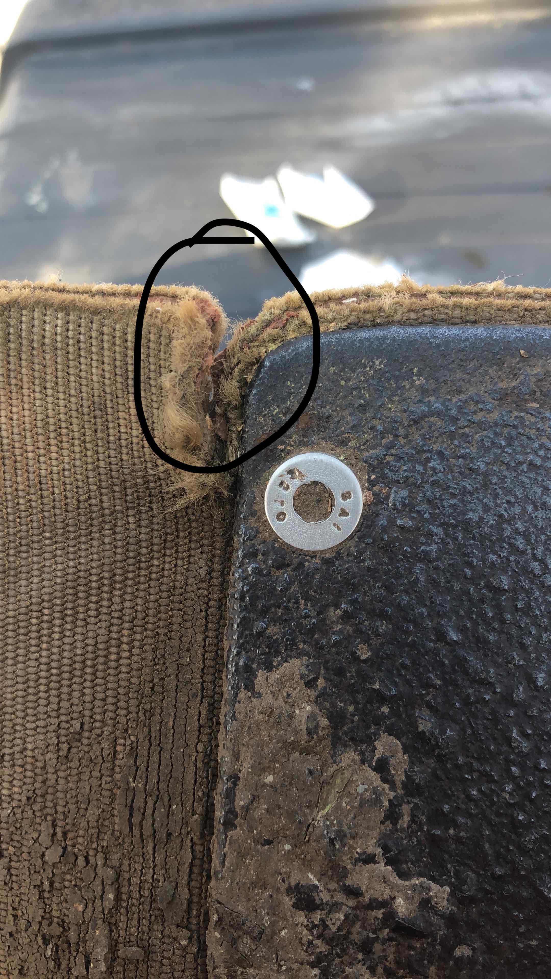
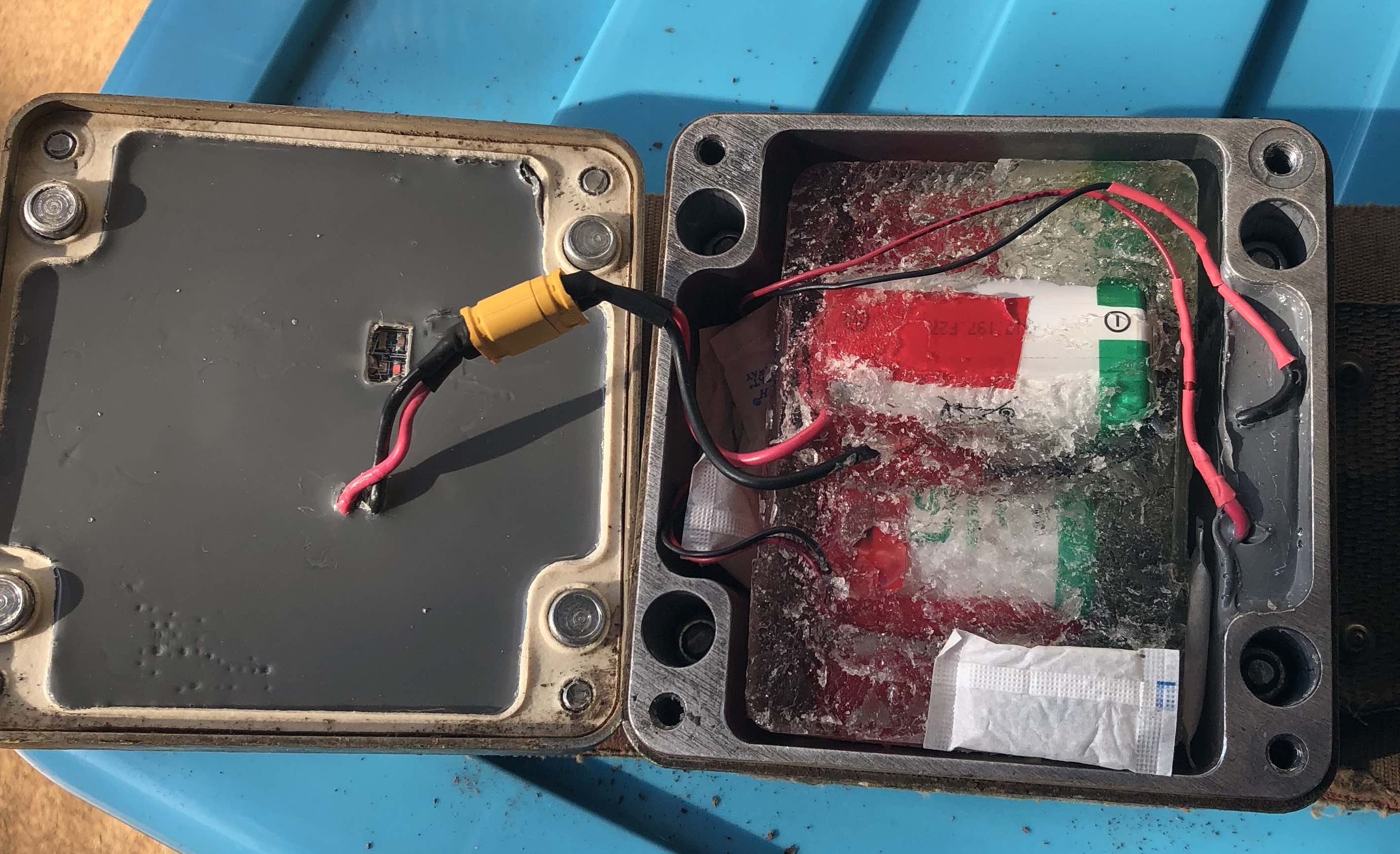
In late 2017 we decided to try and make an elephant collar that was robust enough to withstand the brutality of an elephant moving around in the African bush, but still have enough flexibility in its design to be able to refurbish it in the field. Refurbishing a collar would mean changing the batteries and perhaps the belting if it had worn through. Field-refurbishment of collars saves money because the end-user doesn’t have to buy a replacement collar to fit onto the animal (even at a reduced price). Cost is also reduced because the User doesn’t have to send the collar back to the manufacturer.
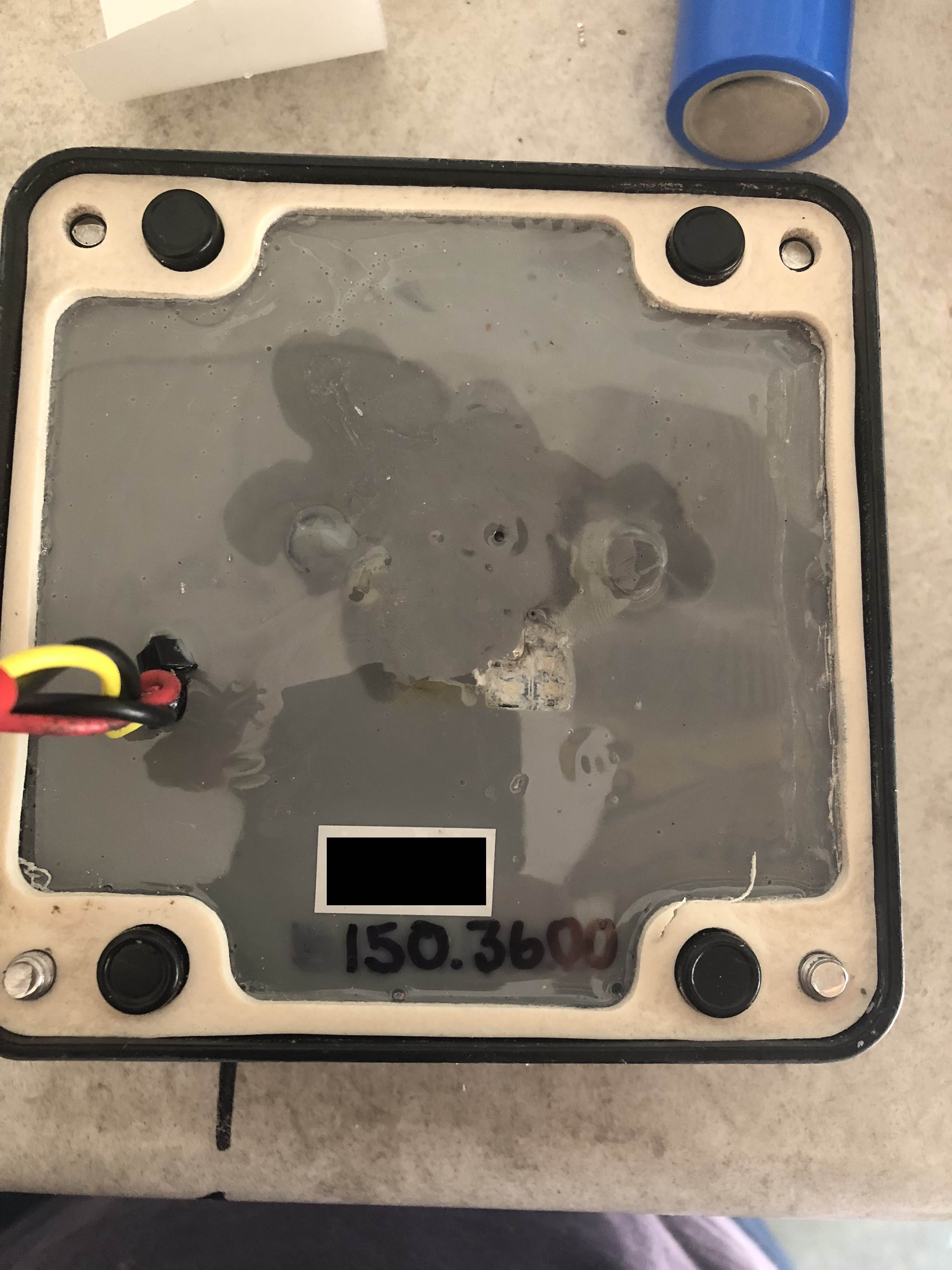
Fig 1: Machined lid of aluminium enclosure. The top had to be machined so that the antennas could have clear sky-view without being limited by the metal enclosure.
One of the other major driving forces behind making an elephant collar that one could replace batteries in the field were the regulations from Aviation Authorities with regards to the shipping of products with Lithium Batteries. We wanted to be able to ship the collar separately from the batteries as well as be able to have the Collar User make up their own battery packs where possible. It would be a simple matter of releasing four screws on the lid of the enclosure, disconnecting the old battery pack and connecting the new one.
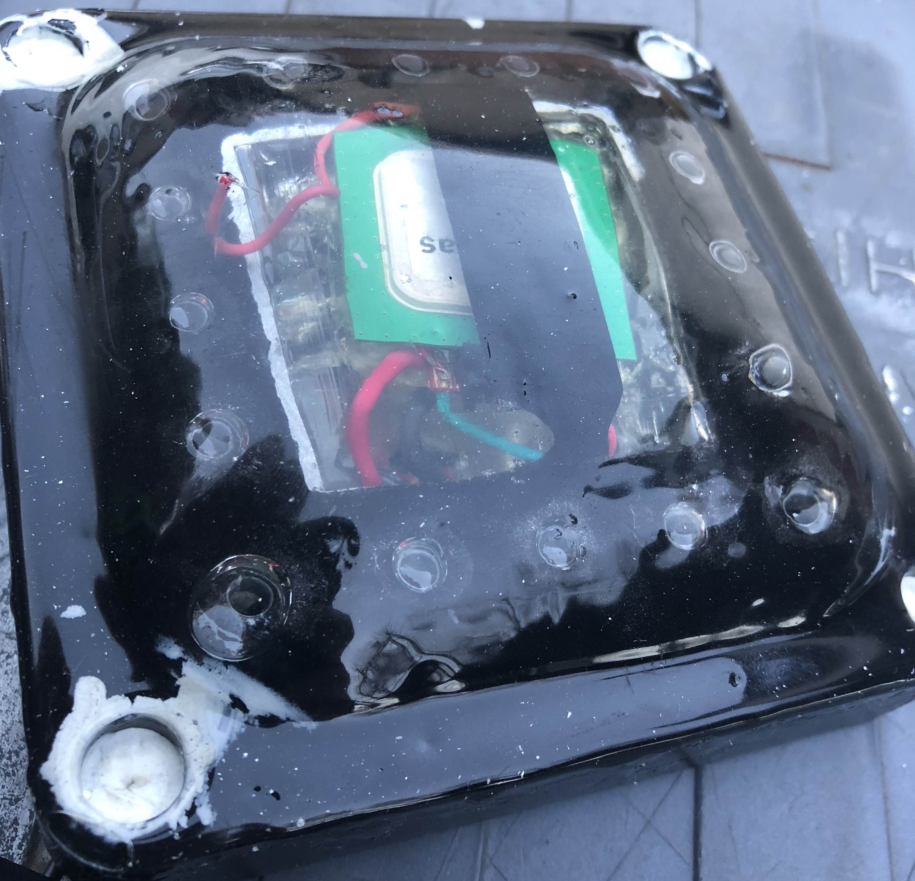
Fig 2: The machined lid was inserted into a custom silicon mould to make the rounded dome. The entire tracking unit was encapsulated in “RF Transparent” polyurethane to allow the Iridium and GPS communication.
The size of the enclosure was an immediate concern. Having a metal enclosure strong enough to bolt onto a belt meant that its profile was relatively high to accommodate the battery pack. We used six D-type lithium primary batteries in each collar. In retrospect we should perhaps have started with three cells. This and the heavy counterweight required to keep the top enclosure facing the sky meant that the strain on the belting was too much. The continuous rocking motion of the elephant walking as well as the occasional snagging of the enclosure on vegetation meant that the belting tore, almost in a straight line, where it was attached to the enclosure.
Fig 3: The belting starting to tear after one year on the elephant. The attachment plate acted like a “ruler tearing paper” and eventually this was the ultimate point of failure.
A failed collar is an expensive exercise, not only from a time and materials point of view but also the additional expense of having to re-collar the animal. Chopper time, vet bills and ground crew are not cheap, not to mention the additional stress placed on the animal during recapture. There is also the reputational damage that a failed collar incurs. We would like all prospective customers to know that we have gone back to making the collars the “old-fashioned” way. Smaller profile and lighter weight. We will have to think of another way to make an elephant collar field-refurbishable! Field testing an elephant collar is not an easy thing to do. The time it takes to judge the success of a design is significant and waiting three years to see if an experimental collar is working in the field before making the production version available is not feasible. We hope that this post will help future collar manufacturers learn from our design flaws and improve on them.
Fig 4: The inside of the enclosure showing the replaceable battery pack with six D-type lithium batteries.
For more information on this story, or to find out about collar-making, please give me a shout at jason@awetelemetry.co.za. I am happy to share my experiences so that we can all make better collars in the future.
AWE Telemetry Systems is proud to announce that it has recently launched a new range of wildlife tracking collars that include some notable additional* communication pathways to the wildlife telemetry market.
Communication Pathways
Iridium (Duplex)
Globalstar (Simplex)*
GSM
UHF
VHF
LoRa*
Our products deliver essential data to reserve managers and researchers to enable informed management decisions and accurate conservation research. The electronics and systems that we produce (since 2003) have a proven track record. They have been used in thousands of wildlife collars deployed throughout the world by commercial wildlife collar manufacturers using our robust technology. Now our new range of wildlife collars takes reliability to the next level.